ELSIPOGTOG - Large caravans of pick up trucks, fuel trucks, security trucks and a variety of other equipment continue to depart from the Moncton Holiday Inn on a daily basis. SWN's contracted workers, the majority of whom are currently employed by Houston-based company Geokinetics, have been residing at the Holiday Inn for weeks now.
The daily pattern for most workers, as of this week, is a 6:45am visit to the Tim Horton's counter at the local gas station. They then begin the process of organizing themselves for the 93 kilometer journey north along highway 126 to Rogersville. Some pieces of equipment do exit the highway earlier than Collette road, just north of Rogersville. It is not currently established where they work for the day.
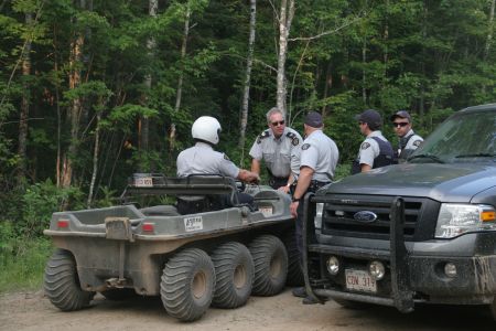
The majority, as of July 10th, now take the Collette road exit. Equipment is usually flanked by security trucks, who, despite the illegality of the action, have been known to block Collette road against any non-SWN associated traffic. The majority of the security force is at the moment employed by Irving-owned Industrial Security Limited.
What happens then is a bit of a mystery. The equipment, which includes at least two 'shot-hole' drillers, is supposed to be running a north-south seismic testing line, with the Collette road entrance to the line representing near the northerly extremity of the line.
Due to continuous RCMP assistance in blocking access to the roads, aerial surveillance and walking scouts currently represent amongst the only means of gathering information as to the progress of the seismic line.
Both means of data gathering have painted an as-yet incomplete picture of the work, but scouts along the southern tip of the line report east-west cross roads having been flagged and laid with drilled charges. Whether all these charges have been detonated or not is unknown.
To the north of the line, aerial data gathering has indicated that SWN has moved slightly to the east of the seismic line route they have publicly presented in available maps. Instead, they appear to have begun to carve themselves a north-south clear cut line that begins at coordinates N 46 41.155 W 65 32.699. How far this line goes and where equipment is on this line is currently unknown.
This seismic line cuts squarely through traditional Mi'kmaw hunting grounds, and it is not uncommon to spot moose, deer, bear, fox and porcupines wandering through the terrain. The northern section of the line also appears to have some sizeable wetlands in it, and the line itself is on the Northern tip of the Richibucto River watershed.
The Richibucto watershed, according to a 2008 Ecosystem Overview published by the Department of Fisheries and Oceans, is the fourth largest river basin in Eastern New Brunswick.
The watershed is also not particularly well-suited to industrial incursions. The peat moss industry, by no means comparable to the water-intensive process of hydraulic fracturing, has notably caused chemical and heavy metal contamination of the watershed, as well as threats to the ecosystem productivity, threats to aquatic fauna and changes to behaviour in aquatic species.
According to the Shale Gas Information Platform, a typical hydraulically fractured well requires anywhere from 10 to 30 million litres of water per well. The consequences of removing this much water, per well, from the Richibucto watershed - and walking scouts suggest there are scores of potential wells along line 5 alone - are not known.
With only the Atlantic Industrial Services plant in Debert, Nova Scotia, available to potentially 'treat' this water, what will happen to all the post-hydraulically fractured water is also not known. The Debert plant has a maximum capacity about equivalent to two fractured wells, and has already been caught dumping over 7 million litres of untreated post-hydraulically fractured water down the municipal sewer system in Windsor, Nova Scotia.

![Terrain in line 5 is relatively pristine, and comprises traditional Mi'kmaq hunting grounds. [Photo: Miles Howe] Terrain in line 5 is relatively pristine, and comprises traditional Mi'kmaq hunting grounds. [Photo: Miles Howe]](../../sites/mediacoop.ca/files2/mc/imagecache/page450/img_8384.jpg)
![Aerial surveillance notes that SWN has begun to cut a seismic test line through the bush. The coordinates for the northern head of the line are: N 46 41.155 W 65 32.699 [Photo: Miles Howe] Aerial surveillance notes that SWN has begun to cut a seismic test line through the bush. The coordinates for the northern head of the line are: N 46 41.155 W 65 32.699 [Photo: Miles Howe]](../../sites/mediacoop.ca/files2/mc/imagecache/page450/img_8406.jpg)


